El Mont Blanc o Monte Bianco —orónimo en francés e italiano, respectivamente; traducido al español como ‘Monte Blanco’— es la montaña granítica culminante de los Alpes, con una altura oficial de 4810,06 msnm(según la última medición en septiembre de 2013).1 Es el punto más elevado de la Unión Europea y uno de los más altos del resto de Europa, superado solo por varias montañas de Rusia y Georgia como el Elbrus(5642 msnm).3
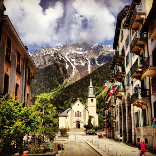
Rodeado de valles con numerosos glaciares, el Mont Blanc forma parte del macizo homónimo que se extiende entre las demarcaciones del Valle de Aosta, en Italia, y de Alta Saboya, en Francia. Las ciudades más pobladas cercanas al Mont Blanc son Chamonix-Mont-Blanc y Saint-Gervais-les-Bains, situadas en Francia, y Courmayeur en Italia.4 5
La situación de la cima es compartida entre Italia y Francia por un tratado internacional de 1860, aunque desde entonces se mantiene cierta controversia y diferentes fuentes cartográficas atribuyen enteramente la ubicación a uno de ambos países. Así, los mapas del Instituto Geográfico Nacional de Francia incluyen toda la cumbre dentro de las propias fronteras, lo que contrasta con el mapa geográfico del Archivo de Estado deTurín, según el cual la cima es íntegramente italiana.6
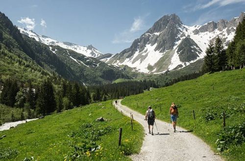
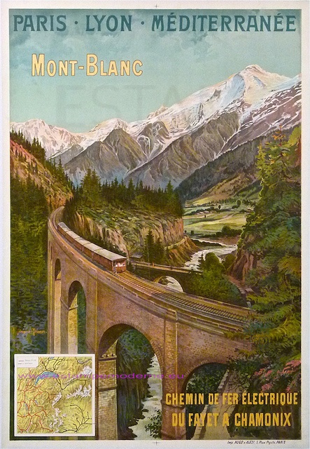
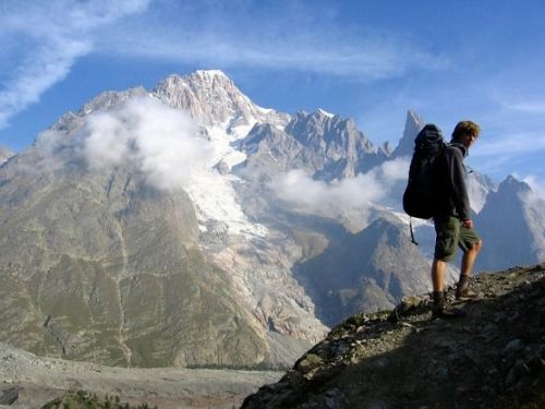
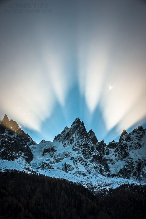
Numerosos glaciares se encuentran a su alrededor: al sur los glaciares de Freney, de La Brenva, de Miage, del Mont Blanc y de Brouillard, y al norte, los glaciares de Bossons y de Taconnaz. En 1957 se inició la construcción del túnel de Mont Blanc (se terminó en 1965), que tiene 11,6 km de largo y es una de las mayores rutas de transporte transalpina, ya que une a Italia y Francia.7 El macizo del Mont Blanc es la cuna delalpinismo, cuyas expediciones empezaron hacia el siglo xviii, siendo un destino de referencia en Europa para la práctica del senderismo, el esquí y el snowboarding.
Historia
La montaña maldita

Le prieuré de Chamouni, le mont Blanc, l’aiguille du Goûter, le glacier des Bossons, pintado por Jean-Antoine Link.
Hasta el siglo XVII era denominado habitualmente «Montaña maldita» por los habitantes de la región,8 de hecho una montaña del macizo aún mantiene esta denominación, el monte Maldito. A principios de siglo se realizaron varias procesiones entre los habitantes de Chamonix, debido a que la mer de Glace (un glaciar del macizo) se acercaba peligrosamente al pueblo.
Un mito cuenta que existía un reino encantado en la cumbre, donde estaba la reina de las hadas, la «diosa blanca», que vivía en prados verdes e hilaba el destino de los habitantes del valle. Según las creencias de la época, estas entidades divinas debían ser respetadas y veneradas, ya que las cumbres emitían un tipo de influencia, una fuerza sobrenatural, que guiaba a los hombres sin que ellos lo supieran y cuya influencia podía ser buena o mala, según los casos. Con el cristianismo se consideró a estas divinidades como demonios invisibles y hostiles.
En el verano de 1741, el viajero inglés William Windham (1717-1761), que ya había realizado expediciones en Egipto y en Oriente, organizó junto con Richard Pococke una expedición de descubrimiento al valle de Chamonix, que tenía entonces la reputación de ser un lugar inhóspito y peligroso.9 Cuando llegó, se maravilló del aspecto del valle y de los precipicios, que según él, «podían espantar las almas más firmes». Subieron hasta el lugar llamado Montenvers, en el lateral del glaciar que Windham bautizó como mer de Glace (‘mar de Hielo’), y fueron los primeros en observarlo y mostrar el interés que representan los glaciares. Windham recogió también algunas leyendas de los lugareños que afirmaban que por la noche, sobre los glaciares, se efectuaban fiestas de brujos que bailaban al son de la música.10 Con el racionalismo de finales del siglo XVIII, y al triunfar el materialismo del siglo XIX, se perfeccionaron los conocimientos científicos sobre la montaña y se intensificaron las exploraciones.
Expediciones y pioneros
En 1760 un científico de Ginebra, Horace-Bénédict de Saussure, ofreció 20 táleros a los primeros montañeros que consiguiesen encontrar una ruta hasta la cumbre del Mont Blanc,11 la cual llevaba tiempo observando durante las anteriores expediciones que había realizado en el macizo. Se sucedieron varios intentos, hasta que el día 8 de agosto de 1786 dos aficionados bien entrenados de Chamonix, Jacques Balmat (buscador de cristales de 24 años) y el doctor Michel Gabriel Paccard, quien quería observar el comportamiento de un barómetro aneroide a esa altura, subieron hasta la cumbre pasando por Grands Mulets y bajaron sanos y salvos; siendo ésta laprimera ascensión.2 12 La expedición fue considerada en su tiempo absolutamente extraordinaria, también debido al aura de supersticiones, leyendas y tabúes que rodeaban a la montaña. En la cima se quedaron durante media hora, el tiempo suficiente para que Paccard pudiera comprobar la acción de la presión atmosférica con el barómetro de Evangelista Torricelli, confirmando la teoría de Blaise Pascal (y repitiendo el experimento llevado a cabo a su instancia por Florin Périer, su cuñado) sobre la reducción de la presión al aumentar la altitud.
Un año después, el 3 de agosto de 1787, el promotor de esta aventura, Horace-Bénédict de Saussure, pisó también la cumbre, acompañado por su criado, Jacques Balmat y dieciocho personas entre guías de Chamouni y portadores para llevar diversos equipos científicos.13 En la cima mandó instalar una tienda de campaña antes de proceder al cálculo de la altitud, efectuando mediciones que sirvieron como primera aproximación sobre la altitud de la cima. Entre todos transportaban víveres, una escalera, una cama, una estufa y un laboratorio científico con higrómetros, barómetros y termómetros, y otros instrumentos de medición. Tras esta expedición y otras dedicadas a la geología, la botánica y la cristalografía de los Alpes, escribió libros como Relation abrégée d’un voyage à la Cime du Mont-Blanc: en août 1787 y Voyages dans les Alpes.14
La primera mujer en alcanzar la cima fue Marie Paradis, el 14 de julio de 1808, acompañando a Jacques Balmat.15 16 La segunda ascensión femenina fue la de la alpinista y periodista Henriette d’Angeville, el 4 de septiembre de 1838, que publicó un diario de su ascensión.17 En cuanto a la primera ascensión invernal femenina, fue la de Isabella Stratton en 1876.18

El 6 de agosto de 1864, el geólogo y alpinista Felice Giordano fue el primero en efectuar la ascensión por la parte más abrupta, en la vertiente italiana, mientras que la primera ascensión invernal por esta vertiente la realizóQuintino Sella, el 5 de enero de 1888. Achille Ratti, el futuro Pío XI, trazó en 1890 la vía normal de la vertiente italiana, contribuyendo así a dar a conocer la ciudad de Courmayeur, desde donde parte dicha ruta.19
El 11 de febrero de 1914, Agénor Parmelin fue el primer aviador en sobrevolar el macizo y Marguette Bouvier fue la primera mujer en descender con esquís, en 1929.20 Jean Moine fue el primero en aterrizar con un helicóptero sobre la cima, con un Bell 47 G en 1955. Otros hechos importantes han sido cuando el piloto Henri Giraud aterrizó sobre la cima en apenas 30 metros, el 23 de junio de 1960, el primer despegue con un ala deltapor Rudy Kishazy en 1973, el primer despegue con parapente por Roger Fillon en 1982 y el primer aterrizaje con un paracaídas por Tony Bernos en 1986.21 16
Fuente:
http://es.wikipedia.org
=======================((((((((((((((((((()))))))))))))))))))))))))))oooOOOOOOO==============

MONT BLANC
Mont Blanc (French pronunciation: [mɔ̃.blɑ̃]) or Monte Bianco (Italian pronunciation: [ˈmonte ˈbjaŋko]), both meaning «White Mountain», is the highest mountain in the Alps and the highest peak in Europe outside of theCaucasus range.[1] It rises 4,810 m (15,781 ft)[2] above sea level and is ranked 11th in the world in topographic prominence. [3]
The mountain lies in a range called the Graian Alps, between the regions of Aosta Valley, Italy, and Haute-Savoie, France. The location of the summit is on the watershed line between the valleys of Ferret and Veny inItaly and the valleys of Montjoie Valley and Arve Valley in France. The Mont Blanc massif is popular for mountaineering, hiking, skiing, and snowboarding.
The three towns and their communes which surround Mont Blanc are Courmayeur in Aosta Valley, Italy, and both Saint-Gervais-les-Bains and Chamonix in Haute-Savoie, France — the latter being the site of the first Winter Olympics. A cable car ascends and crosses the mountain range from Courmayeur to Chamonix, through the Col du Géant. Begun in 1957 and completed in 1965, the 11.6 km (7¼ mi) Mont Blanc Tunnel runs beneath the mountain between these two countries and is one of the major trans-Alpine transport routes.
History
The first recorded ascent of Mont Blanc was on 8 August 1786 by Jacques Balmat and the doctor Michel Paccard. This climb, initiated by Horace-Bénédict de Saussure, who gave a reward for the successful ascent, traditionally marks the start of modern mountaineering.[4] The first woman to reach the summit was Marie Paradis in 1808 and the first dog without human technical help was «Tschingel» from Grindelwald (even before first female honorary member of Alpine Club).
Now the summit is ascended by an average 20,000 mountaineer-tourists each year and could be considered an easy, yet long, ascent for someone who is well trained and used to the altitude. This impression is reinforced by the fact that from l’Aiguille du Midi (where the cable car stops), Mont Blanc seems quite close, being merely 1,000 m (3,300 ft) higher. While seeming deceptively close, La Voie des 3 Monts route (known to be more technical and challenging than other more commonly used routes) requires much ascent and descent before the final section of the climb is reached and the last 1000 m push to the summit is undertaken.
There are deaths on Mont Blanc every year, and on the busiest weekends, normally around August, the local rescue service performs an average of 12 missions, mostly directed towards people in trouble on one of the normal routes of the mountain. There are routes that require knowledge of high-altitude mountaineering, a guide (or at least a veteran mountaineer), and proper equipment. It is a long course that includes delicate passages and the hazard of rock slides. Also, at least one night at the refuge is required to acclimatize to the altitude; less could lead to altitude sickness and possible death.[5][6]
Ownership of the summit

Captain Mieulet map of 1865 showing the border through Mont Blanc, called «a historical falsehood» by Italian historians[7]
Since the French Revolution the issue of the ownership of the summit has spurred many debates. From 1416 to 1792, the entire mountain was within the Duchy of Savoy. In 1723 the Duke of Savoy, Victor Amadeus II, acquired the Kingdom of Sardinia. The resulting state of Piedmont-Sardinia was to become preeminent in the Italian unification.[8] In September 1792, the French revolutionary Army of the Alps under Anne-Pierre de Montesquiou-Fézensac seized Savoy without much resistance and created a department of the Mont-Blanc. In a treaty of May 15, 1796, Victor Amadeus III of Sardinia was forced to cede Savoy and Nice to France. In article 4 of this treaty it says: «The border between the Sardinian kingdom and the departments of the French Republic will be established on a line determined by the most advanced points on the Piedmont side, of the summits, peaks of mountains and other locations subsequently mentioned, as well as the intermediary peaks, knowing: starting from the point where the borders of Faucigny, the Duchy of Aoust and the Valais, to the extremity of the glaciers or Monts-Maudits: first the peaks or plateaus of the Alps, to the rising edge of the Col-Mayor». This act further states that the border should be visible from the town of Chamonix andCourmayeur. The summit is not visible from the village of Courmayeur, because part of the mountain lower down obscures it, although it is visible from other hamlets within Courmayeur’s municipality. The official French maps still portray the border following this concept, putting the summit area entirely in France.

A Sardinian Atlas map of 1869 showing the summit lying two thirds in Italy and one third in France.[9]
After the Napoleonic Wars the Congress of Vienna restored the King of Sardinia in Savoy, Nice and Piedmont, his traditional territories, overruling the 1796 Treaty of Paris. Forty-five years later, after theSecond Italian War of Independence, it was replaced by a new legal act. This act was signed in Turin on 24 March 1860 by Napoleon III and Victor Emmanuel II of Savoy, and deals with the annexation ofSavoy (following the French neutrality for the plebiscites held in Tuscany and Emilia-Romagna to join the Kingdom of Sardinia, against the Pope’s will). A demarcation agreement, signed on 7 March 1861, defines the new border. With the formation of Italy, Mont Blanc is for the first time located on the border of France and Italy.
Currently the 1860 act and the maps attached are still legally valid for both the French and Italian governments.[10] One of the prints from the 1823 Sarde Atlas,[11] positions the border exactly on the summit edge of the mountain (and measures it to be 4,804 m (15,761 ft) high). The convention of 7 March 1861 recognises this through an attached map, taking into consideration the limits of the massif, and drawing the border on the icecap of Mont Blanc, and therefore makes it both French and Italian. Watershed analysis of modern topographic mapping not only places the main summit on the border, but also suggests that the border should follow a line northwards from the main summit towards Mont Maudit, leaving the south east ridge to Mont Blanc de Courmayeur wholly within Italy. Despite the fact that the Franco-Italian border was redefined in both 1947 and 1963, the commission made up of both Italians and French ignored the Mont Blanc issue. The current situation sees administration of the mountain being shared between the Italian town of Courmayeur and the French town of Saint-Gervais-les-Bains, although the larger part of the mountain lies within the commune of the latter.
Fuente:
http://en.wikipedia.org


 Monasterio de Maulbronn © Silvan Rehfeld


_08.jpg)


.jpg)


.svg)


.jpg)


